Virtual Terrain Locations - International
Parts of the world will become virtualized as time and people arise to tackle
them. If you are working on any particular location and are willing to
be listed here, please let us know!
Global
-
Grids and Datums
for many countries, from the ASPRS
- Bruce Gittings' amazing resource with global coverage:
Digital Elevation Data Catalogue
- INTEC Americas Corp. is a commercial
data provider
- they sell imagery, DEMs, DRGs, and other products for a very long list
of countries
- see their International
Digital Map Pricing, typical cost for a DEM is $600 per 'map sheet'
- How they produce data: The topo quads are purchased in
printed form, usually from the local government. The maps are scanned,
then a semi-automatic or manual process is used to extract the contour vectors.
In the case of 1:50,000 scale printed maps, there is enough accuracy to
produce 30m DEMs. However, with 1:250,000 scale maps, no more than
90m/3 arc-second is feasible.
- East View Geospatial is another
commercial provider
- primary geospatial data is scanned topo maps and DEMs, usually 2-arcsecond
'regional' maps in 15x15 minute blocks at $130 each, with sparse coverage
internationally
- See also:
- The UC Berkeley Digital
Topographic Map Sets has scanned topo maps (generally large JPEG images)
for a large number of countries
- The UNEP WDPA (World Database
on Protected Areas) is a free SHP dataset with a point feature for every
protected area (park, natural area, reserve..) in the world. A smaller
dataset has polygonal data for a few countries, but otherwise most places are
only located by a single point.
- Pleiades (previously
the Stoa Waypoint Database) is a free, open repository of geographic coordinates
for sites, features, objects, routes, etc. of the ancient world
- Administrative Boundaries
-
Public geospatial data on the OpenStreetMap wiki is a good starting
point for raw data that is free enough for the OSM license.
Antarctica
- The US Antarctic Resource Center has
DEMs, imagery and other layers for parts of Antarctica, as well as a web-based
Map Browser for 2D browsing of available data

- RAMP (the NSIDC DAAC
Radarsat Antarctic Mapping Project)
- has produced the RAMP
DEM Version 2
- it incorporates satellite radar altimetry, airborne radar surveys, the
Antarctic Digital Database (version 2), and large-scale topo maps from the
USGS and the Australian Antarctic Division
- 1 km, 400 m, and 200 m resolution, in a polar stereographic projection
(71 degrees south, South Pole as origin)
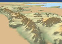
- snapshot at right from Enviro rendering a subset of the 400m dataset
Arctic
Caribbean
- Jamaica
- NEXTMap Jamaica
is commercial elevation at 5m spacing, reasonable pricing for small areas;
$40k to license the whole dataset
- Puerto Rico - see United States
Oceania
- Australia
- Indonesia
- New Caledonia
- Contact: Bruno Granger of UBIQ Nouvelle
Calédonie has:
- aerial orthophoto which they made in September 2003, TIFF+Tfw format
- DEM, which reportedly is available for purchase from the US Army
- they distribute scanned IGN topo
maps
- they have an interactive web map of the territory
- New Zealand
- Solomon Islands
- NEXTMap Solomon
Islands is commercial elevation at 5m spacing, reasonable pricing for
small areas; $65k for the whole dataset
- Vanuatu
- NEXTMap Vanuatu
is commercial elevation at 5m spacing, reasonable pricing for small areas;
$45k for the whole dataset
