- contact: Sergio Muñoz [ighsmjgua@guate.net], a hydrogeologist working in Guatemala City, can provide some data and services, he has worked with the hydrology available from the INSIVUMEH (national institute) and created his own DEMs
- contact: Billy Pineda [billypineda@conred.org.gt]
writes:
"I have DEMs 1:20,000 from the active volcanoes, also DEMs 1:50,000 from the most of the country and one DEM 1:250,000 from the entire country, about imagery I have a couple of mosaics of the country with LandSat 7, also some aerial photos, orthophotos and a lot of thematic data (rivers, roads, railroads, geology, population centres, towns, precipitation, evapotranspiration, temperature, etc... )"
- DEMs for México
- distributed by INEGI (National Institute of Statistics, Geographics and Information), a government institution
- they used to be expensive, about $2000 US for 256 one degree by one degree grids of 3 arc second resolution (named GEMA and distributed on CD)
- Now (as of 2005) you can download, for free, 1:50,000 DEM of all of Mexico, as well as the Southern US, at this page on the INEGI website. You have to register to access the DEMs and immediately you can download sections of 1 by 2 degrees. This data is called El Continuo de Elevaciones Mexicano (CEM). Resolution is 1 arc-second (~30m) and the data looks good, although there are some TIN artifacts so accuracy may be lower.
- Also, if you are not going to use it for commercial purposes, you can download them from North American Landscape Characterization (NALC) or from ARIA (University of Arizona)
- Topo maps
- INEGI lists 522 topo quads at scale 1:50,000 in printed form, and the search page for digital data will report what data exists (but not how to get it). There is also another search interface. Reportedly: "Information is not free and you have to fill out and sign a form stating how you are going to use the information. Sometimes you have to wait for one to three days in order to receive the bought information."
- INTEC Americas --
Mexico Geo Data State Promotions sells data bundled by state (e.g. $36,478
for 90m DEM for the whole country)

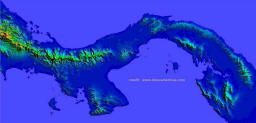
- INTEC Americas offers an off-the-shelf 90m DEM of Panama along with country-wide road vectors and 250k DRG coverage. 30m DEMs, road vectors from 50k and LandSat-derived land use clutter is available off the shelf for the 3 largest cities – Panama City, David and Colon.
- Isla Coiba
- subject of a visualization project in 2002-2003, involved in a decision on how to develop the island
- a good elevation and texture are in the BT repository