Notes on OpenStreetMap
Although OpenStreetMap
(OSM) has a very different goal and purpose (cartography) than the VTP (full 3D
reality), it is potentially a useful starting point in some parts of the world,
providing a base map, and in some cases even some primitive 3D data.
OSM Data
- OSM is stored in a large database, but also has an XML format (.osm) for
export/interchange.
- It is simply points ("nodes") and polylines ("ways"), with
topology, using a
very large set of standardized attributes (key/value pairs), which are
applied very rigorously in some areas and inconsistently in others, due
to the volunteered nature of the data.
- Although OSM began as an effort to produce a free streetmap of the
world, by 2010, OSM was increasingly being used to represent things
besides roads - water, building footprints, and even small features like
fences and hedges.
- Using the default web interface on the home page, you can export a
region of interest to an .osm file but this is only
supported for fairly small regions. For larger regions, there are
services like the Geofabrik free
download server, and there are tools like
Osmosis (with a
GUI, OSMembrane) to filter
for features of interest.
- Aside from the main wiki page on
Map Features,
a very useful reference on which tag key/value pairs are actually used
is at
taginfo.openstreetmap.org.
Data collection
- There are three main ways that people add data to OSM:
- Importing an existing dataset, which usually involves a lot of
cleaning up the data.
- Consumer GPS tracks, for example as described in
Grassroots GIS (2010)
- Tracing off of permitted aerial imagery.
- All three of these have significant pitfalls (GPS and aerial
accuracy/agreement, etc.)
- GPS was the most common approach during OSM's early years, but now
tracing aerials is more common.
Roads
- Some small drawbacks to OSM's road model are:
- Roads are simple centerlines, which of course fails badly for
visual representation of large intersections, freeway exits, etc.
- They store every single point in every polyline as its own node
with attributes, which is more overhead than one might hope for an
efficient visualization system.
- Some good things:
- It supports areas for features like parking lots, which could
capture a lot of visually significant paved areas of cities.
- Since roads have a direction, you can flag the presence of
features like sidewalks using left/right/both.
Buildings
Power
3D View
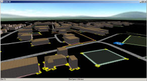
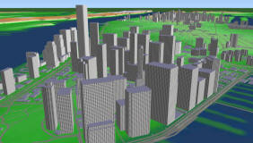
- It is relatively simple to take the OSM export data and extrude the
primitive features (road centerlines, building footprintf) in 3D. There are a number of software tools that do
this:
- Kendzi3D is a plugin for the popular
JOSM editor, which
gives a live 3D view (on a flat plane) of your data as you edit:

- The VTP software (VTBuilder,
Enviro) support importing
from OSM:

- Several other tools and projects (OSM-3D,
OSM2World
... see OSM
Wiki: 3D Development)
- It can even be done in a webpage using only 2D graphics to draw the
3D buildings, as on
osmbuildings.org
- Maperitive is
a standalone tool for rendering OSM, optionally draped on hill-shaded elevation (SRTM is
the default source), with output to bitmaps, SVG or Collada.
Metrics


