- Geological Survey of Alabama
- the Virtual Alabama project is built on Google Earth as a platform, but the data itself is not apparently public; only for the use of certain public officials
- ARIA - Arizona Regional Image Archive - has free online LandSat7 and DOQQ
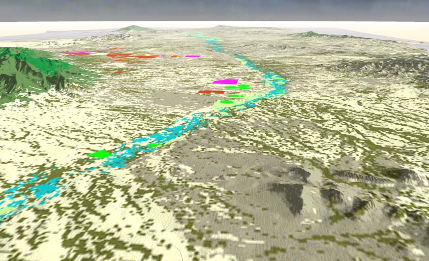
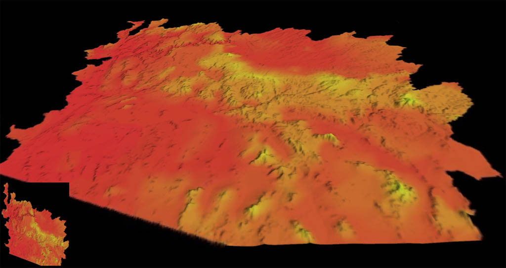
- Visualization of conflicting conservation and development priorities
in the San Pedro River Basin, Arizona and Mexico
- July 2003, this
research project, using roads, buildings, land use classification,
was adapted to a VTP project by Mike Flaxman - snapshots:


- July 2003, this
research project, using roads, buildings, land use classification,
was adapted to a VTP project by Mike Flaxman - snapshots:
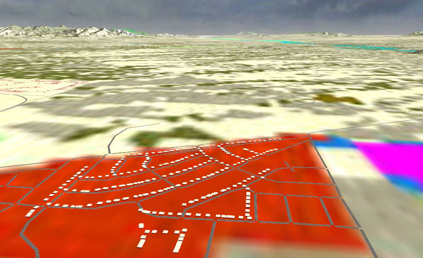
- December 2006, another VTP visualization of the Lower Colorado River
Drainage Basin, by Jason Jessup
at George Mason Univ. in Fairfax, VA. Gathered and visualized geography,
hydrology, population, land use and many other attributes. The area
covers most of what is Arizona.
-
-
University of Arkansas - GeoStor Online Arkansas Spatial Data Infrastructure
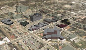
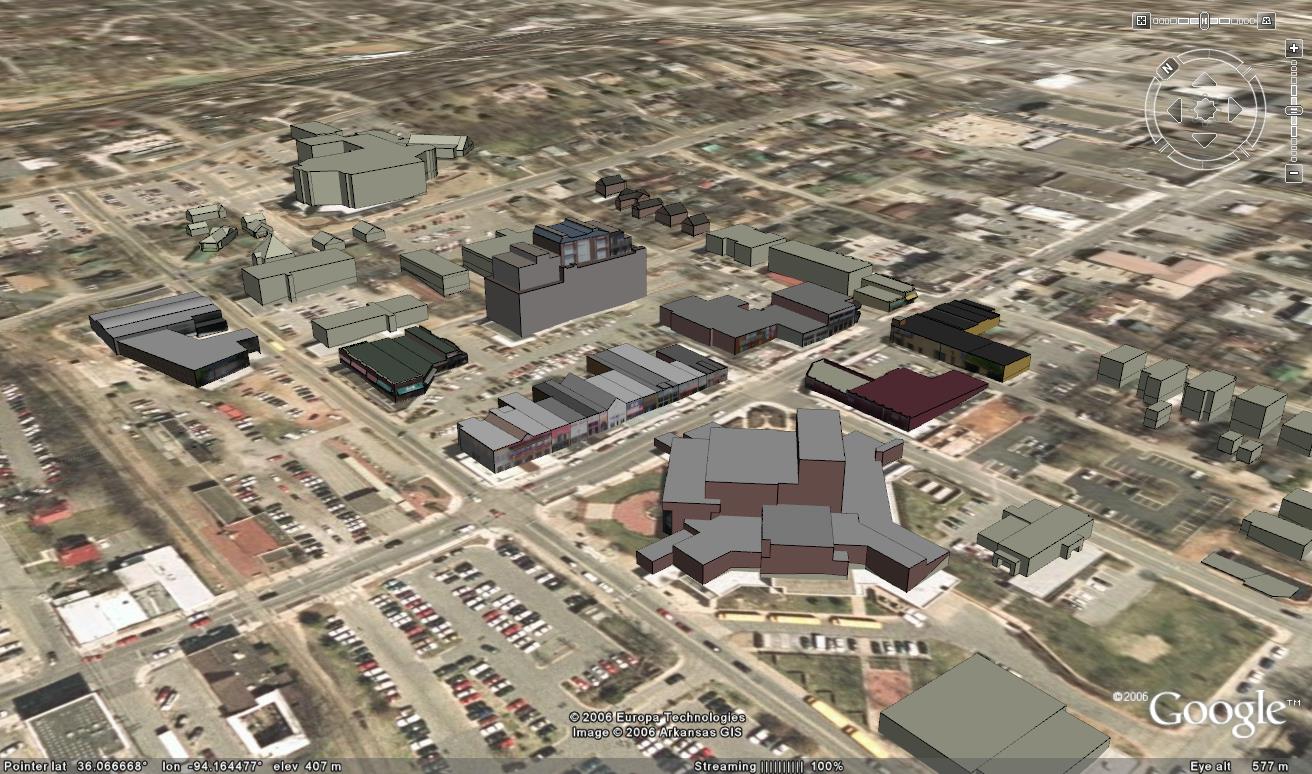
- Also at UA, a Center for Advanced Spatial Technologies (CAST) student project (summer 2006) created a "detailed 3D model of portions of the city of Fayetteville, AR". Unfortunately they used SketchUp/3DWarehouse, so the individual buildings are huge and only usable in GE
- Libre Map Project - Colorado DRG Index
- mew's VTP projects includes work on El Dorado Springs, CO (SW corner of the city of Boulder) and Vail, CO
- In the 3D Warehouse, Colorado Springs in particular, reportedly "a small group of individuals from a few architecture firms modeled the entire downtown core."
- Libre Map Project - Delaware DRG Index
- geotorrent.org has Delware Topographic Map for the entire state (295 MB)
- State website:
Delaware Spatial Data Framework, served via the Delaware
DataMIL
- includes current and historical aerials, and 2' elevation contours from 2007 LIDAR, for 3 counties
- LABINS - Land Boundary Information System has DLG, DRG, and DOQQ for the state
-
 the University of Florida Geoplan
Center gathers Federal, State, and local GIS data and Imagery and distributes
it for "free" (non-redistributable) as part of the
Florida Geographic Data Library (FGDL)
the University of Florida Geoplan
Center gathers Federal, State, and local GIS data and Imagery and distributes
it for "free" (non-redistributable) as part of the
Florida Geographic Data Library (FGDL) - LIDAR of coastal areas has been collected as part of the Florida Coastline Project
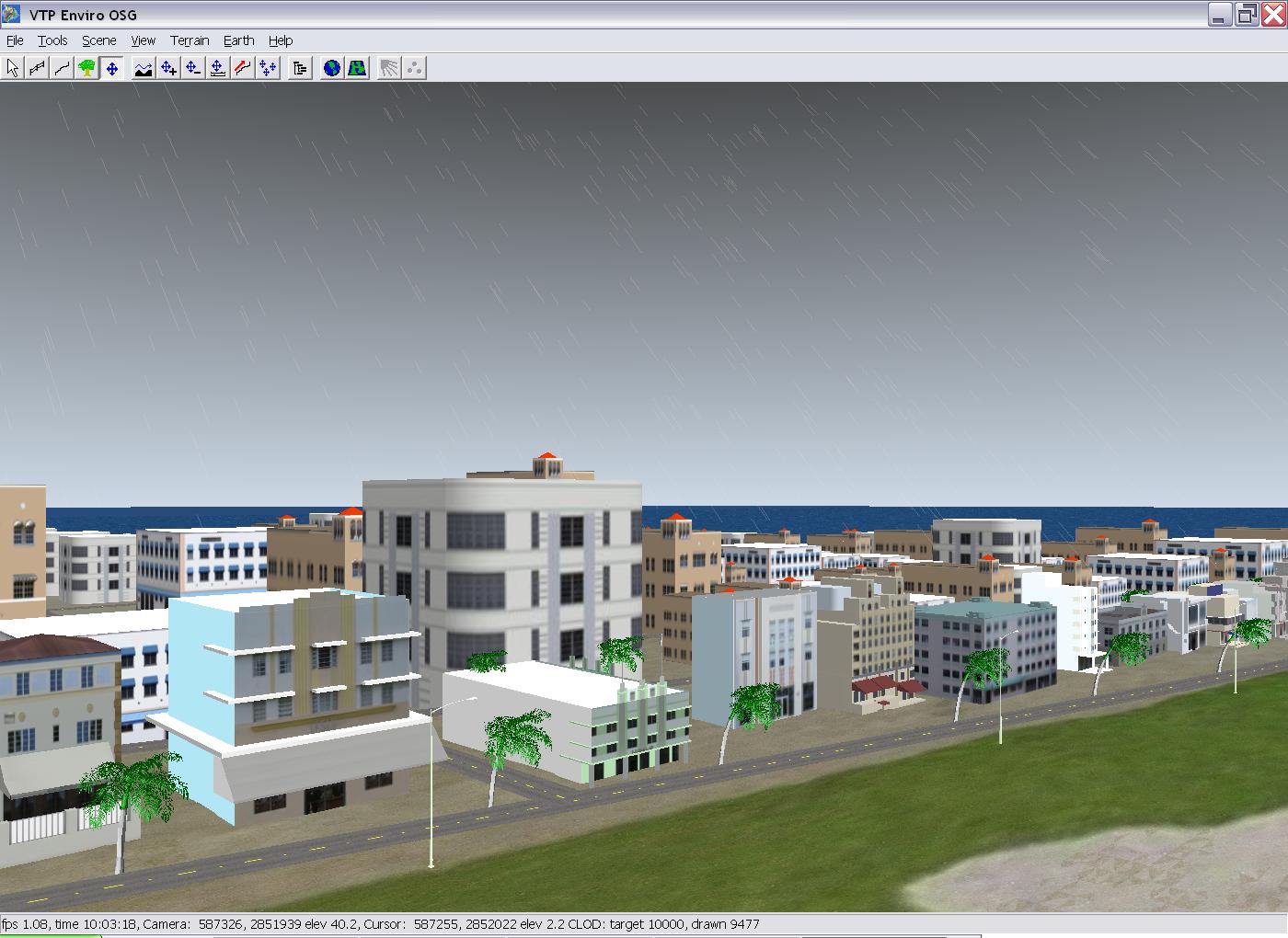
- A
2006 project at Florida International University
produced a VTP-based application with rain, lightning, ocean water,
and tree animation using shaders in CG. Paresh Gupta was the
contact for the project.
- naturally, hurricanes (International Hurricane Research Center) are a subject of significant interest
- INSIDE Idaho (Interactive Numeric & Spatial Data Engine)
- 10m DEMs for parts of western Idaho are on the site UW Geomorphology - Idaho
- Idaho State University's GIS Center
- Idaho LIDAR Consortium
- Illinois Rivers Decision Support Systems - ILRDSS - GIS Animations has non-realtime models of several Illinois rivers, both historical and current data. Software used was ArcInfo, World Construction Set, and LightWave.
- the City of Peoria has been extensively modelled for non-realtime rendering by the company inVision Studios
- Illinois Natural Resources Geospatial Data Clearinghouse has orthophotos and DRGs
- Indiana Spatial Data Services - gis.iu.edu provides access to more than 1.4 Terabytes of Indiana GIS data
- Kansas Geospatial Community Commons (KGCC) has a Geodatabase Catalog
- Kansas Data Access & Support Center (DASC) hosts Elevation and LIDAR, much of it available for download
- Atlas: The Louisiana Statewide GIS
- live index maps to download DEMs, DRGs and DOQQs for Louisiana, including some LIDAR
- city of Baton Rouge has a public DWG of downtown, but i can't find it on their site
- The GIS Spatial Data Server at Radford University has Maryland DRGs and other USGS data
- Massachusetts GIS has a huge amount of data, including color imagery to half a meter resolution! See the Available GIS Datalayers page
- the Triangraphics demo page has a nice demo model of part of Boston as OSG and FLT, includes the airport
- Center for Geographic Information - Michigan Geographic Data Library (MiGDL)
- reportedly there exists a "a PC-based municipal virtual reality model of Birmingham, Michigan" done by Donald R. Fullenwider of CitySimulation, LLC
- MnDNR Data Deli
- aerials for the whole state are at Land Management Information Center Air Photos, FSA NAIP 2003
- LiDAR Elevation Data for Minnesota
- The city is St. Paul was being worked on by Bob Basques of GRITechnologies, he has massively detailed data for the city, but "GeoVRML" was used so none of the models worked when i tried them, even with the same browser (Cortona)
- MSDIS includes DEM and Missouri DRG data
- University of Nebraska GIS Datasets includes a huge amount of data including Nebraska DRGs
- Libre Map Project - North Carolina DRG Index
-
NCDOT Contour and Elevation Data
- 20-foot grids, by County, in ArcInfo format. They look great, but be careful, elevation is stated at meters but is actually feet.
- the Fish Hook Immersive Educational Environment is a project to recreate a 1858 great plains Indian village (along the upper Missouri just south of Bismarck, ND) based off an 1860's map
- North Dakota GIS is a general starting point for data
- ND LiDAR Dissemination Mapservice
- OGRIP GeoData Distribution has USGS data, or it can be browsed at Ohio 1:24,000 Data
-
Ohio Statewide Imagery Program (OSIP)
- version 1 (available, collected 2006-2008) has: 1FT Color Orthophotography in GeoTIFF and MrSID format, 2.5FT DEM in ArcInfo GRID and ASCII grid format, and 2M LiDAR postings in LAS format.
- USGS Crater Lake Data Clearinghouse
- Crater Lake LIDAR (2012) is available at opentopography.org
- Also see Under Trees and Water at Crater Lake National Park, Oregon which links to the bare-earth elevation (massive, 4GB) derived from the LIDAR
- DRGs: Oregon Geospatial Enterprise Office (GEO) or REO: DRGs for Washing and Oregon
- Oregon Geospatial Data Clearinghouse
- Oregon Lidar Collection and Mapping
- 30m DEM from
this
directory at the Penn State Earth
System Science Center
- awkward process of many, many mouseclicks browsing for each file individually
- NED DEMs per county and some other data from PASDA, Pennsylvania Spatial Data Access
- Pennsylvania Spatial Data Access
- Pennsylvania DEMs (7.5 minute and 1 degree): View "Directory" or search by Latitude and Longitude
- Pennsylvania DRGs
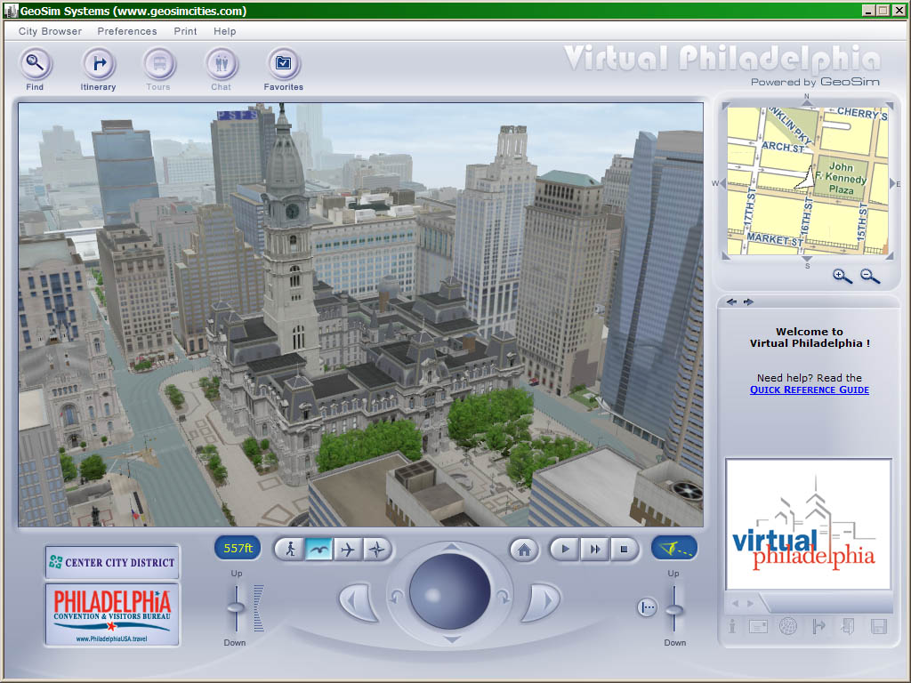
- GeoSim Cities
- Virtual Philadelphia
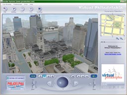
- a detailed model of part of downtown Philly which was created for the center city business district by Israeli company GeoSim
- NY Times article "A 3-D View of the City, Block by Block" (Feb. 17 2005) has more details
- as of April 2008, GeoSim released a free standalone Windows app, GeoSimPHILLY which lets you walk/fly around the model
- The city model itself, while just a portion of downtown, is very detailed and visually impressive, showing a huge amount of work that went into the model. Potted plants and bicycles and dumpsters on the sidewalk, fire escapes on the buildings, every single store sign and awning meticulously modelled. The dynamic aspect, people and cars roaming the streets gives a sensation of reality. Address search and clickable buildings make it (potentially) useful beyond tourism.
- However, the camera navigation is painfully bad.
- Philadelphia has Philly Tree Map
- As of 2011, the platform and database is OpenTreeMap, so it can export tree information as KML or CSV
- AIS Terrain Team (later AIS) created a model of Philadelphia (around 2000) which was meant for use in police/military training and simulation
- these areas are appealing because, as U.S. territories, they have good USGS data availability
- ..and because they're islands
- NEXTMap Puerto Rico is commercial elevation at 5m spacing, reasonable pricing for small areas; $40k for the whole dataset
- Tennessee Federal GIS Data Server
has a lot of good data:
- vector basemap data, including the 7.5' quad grid, highways, city limits
- census data, DOQQ, DRG, and 10m DEM
- Texas Natural Resources Information System has 7.5 minute DEMs and other USGS data
- Houston, in Harris County
- model of downtown available from 3D Cafe: houston.zip 3DS 715k (no longer online)
- downtown consists of 4 quads: houston heights, settegast, bellaire, park place
- 2003.07.11 extracted BT (NAD27) from 30m DEMs at (247213.9, 3266582.7), ( 58487.2, 67187.1)
- Utah GIS Portal points to Utah's State Geographic Information Database (SGID) which has surprisingly high-resolution public data, including 5m & 2m elevation and 1-ft color aerials for a large part of the state.
- AIS Terrain Team (later AIS) created a model of Salt Lake City (around 2000) which was meant for use in police/military training and simulation
- Radford University Spatial Data Server has some Virginia DEMs and DRGs, although the DEMs are not original
- The Virginia Economic Development Partnership (VEDP) GIS page points to a large number of datasets, including CIR DOQQ for the whole state
- The city of Roanoke has very detailed data available on their GIS FTP site that would make an great visualization project: Driveways, property lines, roads, building outlines, railroads, utilities, etc. Most of the data is in DWG and SHP format.
- The official DC GIS
Data Clearinghouse/Catalog has a number of raw data layers
- In July 2008, they announced the release of 3D building data in KMZ format. A post on the Lat Long Blog explains why they made it publicly available.
- However, when i tried to access it, it says "Due to size and system restrictions, the dataset for Buildings - 3D is not available for download. To obtain this dataset, please contact DC GIS."
- The DC Data
Catalog seems to be another official data access site
- It contains links to some useful datasets including Street Trees
- Radford University DRGs has (the single) Washington DC DRG
- AIS Terrain Team (later AIS) created a model of Washington DC (around 2000) which was meant for use in police/military training and simulation
- reported in this press release (2002), the Synchronized Operations Command Complex (SOCC) at Metropolitan Police Department headquarters has a "real-time three-dimensional map of the entire city of Washington, DC"
- DRG and DOQQ from the WVDEP GIS Server
- Radford University DRGs has West Virginia DRGs
- West Virginia State GIS Technical Center has large amounts of data including DEM and DLG
- Wisconsin DNR WebView
- WisconsinView: Aerial and Satellite Imagery of Wisconsin is completely free data