Elevation Contour Data
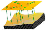
- often, there is no regular elevation grid available - only a set of
contour lines
- the USGS provides elevation contour lines in
DLG format
- it calls them "hypsography vector data"
- fortunately, they also provide the DEM, making their contours
unnecessary
- a common format for storing contours is ESRI Shape files
- if you're starting with paper topographical maps, you will need to scan
it and extract the contours
- use a package such as R2V
($1500) to produce the contour vectors
- are there lower-cost options as well, such as shareware programs?
Converting from irregular points or contour maps to an elevation grid
- R2V itself reportedly provides
this functionality, but there are numerous less expensive options
- Terrainmap.com article:
Extracting DEMs from Topographic Maps shows how to use the R2V demo
- now, on the same Terrainmap.com
website, you can download BLACKART, a free contour interpolation program
which reportedly implements some very powerful algorithms and produces
impressive output
- however, it is still quite rough and requires considerable learning
and experimentation to use
- read some of the
background material on the problem and solutions
- Global Mapper
($250)
- the user-friendly swiss-army-knife of GIS can also convert contour
to grid
- reportedly the process is:
- Export it out to an .xyz ASCII text file (make sure you export
the elevations and feature attributes too).
- Open the ASCII text file using “open generic ASCII text file”
- Choose “create elevation grid from point data”
- This should generate a grid that you can then export to .dem,
.txt, or other common formats.
-
 3DField (shareware, $50)
- small utility for Win32 which can convert points to contours, and
contours to grids
- grids can be saved in .GRD (Surfer Grid format) which can be read in
VTBuilder (i tested this,
and it works)
- also claims to automate digitization of contours from scanned
contour maps (i did not test this)
- Surfer ($600 from Golden
Software)
- it will convert a set of points to a grid, and a grid to contours,
but will it convert contours to a grid? Golden says:
- "Surfer can help you convert the contours to XYZ data with onscreen
digitizing. Load the SHP file with the contours as a base map, select
the map, then choose the Map | Digitize menu. The XY coordinates are
displayed in the status bar (at the bottom of the Surfer window), and
clicking on screen stores the XY coordinates in the digit.bln edit
window. The Z value is not stored automatically, but you can add the Z
value in the Surfer worksheet.
Once you have an XYZ data file for your contours, choose the Grid | Data
menu command to interpolate a grid file from the XYZ data."
- you can save from Surfer in their Grid format (.GRD) which can be
read in VTBuilder
-
 ANUDEM
(~$300 academic, ~$1000 commercial)
- Australian research project that became a product
- runs on Unix (command-line) and Windows (with GUI)
- converts points, contours, stream lines, and lake boundaries into
grids
- makes full use of the hydrology info for much better accuracy
- reads: raw ASCII and standard ArcInfo and IDRISI vector formats
- writes: ArcInfo and IDRISI ASCII and binary grid formats
- surfit (free, open
source)
- calculate regular grid from various data (scattered points, curves,
surfaces, etc), which includes contours
- installer for Windows, RPMs for Linux
-
SurGe
(shareware, Windows only)
- interpolates points, contours and breaklines to a grid
- pro: appears to be quite powerful and flexible in different styles
of interpolation, can output to Arc Ascii Grid
- con: only reads data in its own ad-hoc text format, does not deal
with coordinate systems, UI is quite dated
- GRASS
(freeware)
- can reportedly convert contour vectors to a DEM
- learning curve is substantial, but no worse than a high-end
commercial package (e.g. ArcInfo)
-
ERDAS Imagine (high-end, expensive)
- reportedly, "The IMAGINE 3D-Surfacing tool could translate a
non-regular grid to height-field image. Grid points could be from
point/line ARC Coverage data (or from many sources via ERDAS import
tool) or from text file."
- ESRI ArcInfo (high-end, expensive)
- for people that already own ArcInfo, the TOPOGRID command in the
Grid module will convert contours to grids
- reportedly, ESRI actually licensed the ANUDEM (see above) source
code, so TOPOGRID is basically a slightly out of date version of ANUDEM
- Autodesk Product Line (expensive)
- other possible tools:
 3DField (shareware, $50)
 ANUDEM
(~$300 academic, ~$1000 commercial)