Microsoft
How does the world's most powerful software empire relate to virtual terrain?
Research
- Hugues Hoppe
- TerraServer is a MS research project which split in two in 2000
- "When we launched TerraServer in June 1998, we had SPIN-2 imagery coverage
of Europe, Asia, and other non-US locations. Our lease on the SPIN-2 imagery
was for eighteen months through Aerial Images of Raleigh NC. At the end
of eighteen months (January 2000), Aerial Images decided to host their own
web site at terraserver.com.
Since January 2000, TerraServer-USA
(formally terraserver.microsoft.com) has hosted only USGS imagery of locations
in the United States."
- The commercial branch offers only limited resolution, or full resolution
at subscription cost, but the MS research version is a complete free, full-resolution
WMS for both USGS DOQ and DRG, even
including some color DOQs.
Actual Products
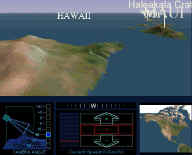
- Encarta Virtual Globe '98
- Jason Dent was a programmer on the team. He gave a talk at the
1999 Game Developer's Conference on
"Rendering the Earth" - summary:
- there is something called the "Olsen (?) land class database", land-use
data for the world
- emphasized the importance of
pre-lighting terrain
- was unimpressed by a Mars flyover running on a Paragon with 256
CPUs at 1 fps
- was attracted to Hoppe's TIN algorithms, and to ray-casting approaches,
but ultimately went with a regular grid, for storage space reasons

- also considers ROAM a
good paper
- Encarta Virtual Globe '99, around $50
- Encarta Interactive World Atlas 2001
- has a "Virtual Flights" feature which appears to be the same 3D flyover
as in Virtual Globe '99
- very limited - can't resize window, can't display any of the same information
as their primary map view, etc.
- Encarta Reference Library 2003 DVD ($60)
- still has the "Virtual Flights" feature, which is, incredibly, apparently
unchanged since 1999's Virtual Globe product!
- Microsoft's Geography Product Unit is the branch of the company responsible
for most of these products, as well as their purely 2D products like MapPoint,
Streets & Trips, and PocketStreets
- In December 2005, Microsoft bought GeoTango
GlobeView, a reasonably sophisticated virtual terrain application.
As of 2006, it remains to be seen whether they will try to advance and promote
this product to compete with Google Earth.
- both Microsoft's
Flight Simulator
(MSFS) and Train Simulator
(MSTS) contain a large amounts of virtual terrain functionality
- unfortunately both are closed, proprietary systems, rendering them useless
for anything other than their narrow gaming purposes
- in fact, they don't even share one bit of functionality between them,
everything is duplicated and non-transferable
- despite this, there are plenty of applications creating virtual terrain
specifically for these packages
- for MSFS, see the page on Flight
Sims
- for MSTS, there is:
TS TerraForm is a freeware product that supports both MSTS and Trainz
Virtual Earth 3D
- Microsoft's newer 3D terrain visualization software; created around
2005 via acquisition of GeoTango, then in 2009 given the bizarre and
whimsical name "Bing Maps 3D"
- It apparently does not have a website of its own, only exposed to users
as a component inside the site at
www.bing.com/maps
- Only runs as an OCX inside Internet Explorer (not standalone, no other
platforms or browsers).
- Content is static. No way to display your own data or turn features
on/off as there is with Google Earth.
- Includes attractive 3D models of landmark buildings for a few US cities
(from Harris Corp's RealSite)
