Government / Academic
Terrain Tools and Research Projects
- EarthSLOT - Science,
Logistics, and Outreach Terrainbases
- A collection of pointers to scientific visualizations on 3D terrain
which are built on top of a variety of earth viewing software,
including: Google Earth, Skyline TerraExplorer, WorldWind, and
GeoFusion. They refer to these visualization as "applications",
although they are more generally datasets.
- Their mission is "to
advance earth science and earth science education through the use of
on-line 3D terrain visualization and GIS tools."
- Includes some
interesting datasets
in Alaska, the Arctic and Antarctic, with an emphasis on geologic
features including hurricanes, earthquakes and glaciers worldwide.
- Terrain
Visualization
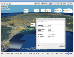
at the CRS4 Visual Computing Group
- Infinite Universe Engine - IUE
- Infinite Universe Engine is an impressive GPL-licensed renderer of
the entire solar system
- by Jochen Winzen at the University of Karlsruhe, 2003
- it does not have a website of its own, so i have created a page
for it here on the VTP site
-
 LandView Terrain Viewer
- A set of 3D software and map/image files from the
U.S. EPA that let you fly over a
representation of real areas in the United States, and in doing so, to
view the location of EPA-regulated sites, as well as population
statistics for any radius.
- The viewer is free and Windows-only.
- built on the
ChunkLOD
library (see LOD
implementations) for support of very large datasets: each city model
is around 125-300 MB in size.
- Though the terrain viewer is still in beta, many areas already
available (Boston, Baltimore, New York City, Reston VA, Seattle, St.
Louis, Tulsa OK, Maine, Richmond VA)
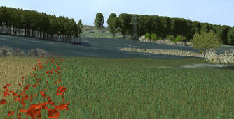
- Lenné3D

- A 3-year German project started May 2002 at
ZALF, for research in computer
graphics, landscape modeling and visualization.
- The project developed a system for interactive 3D landscape
visualization both from map view and from stroller’s view. The 3D
visualization system is supposed to support the dialogue on community
landscape planning and decision-making. As an interdisciplinary project,
it focuses on visualization of vegetation and GIS data as well as
interactive exploration and editing of spatial data.
- Many of the resulting papers are published in
Trends in
Real-Time Landscape Visualization and Participation, Proceedings at
Anhalt University of Applied Sciences 2005
- The Lenné3D project was (2005) spun off as a commercial company,
Lenné3D GmbH (see
Plant Software)
- OBVIO
- academic research demo, based upon OpenGL & GLUT
- self-contained, with St. Helens 1K sample terrain
- uses a very nice-looking (unknown) LOD algorithm
- RATMAN
- The acronym is for "Rapidly Adaptive Terrain Models Available on the
Net"
- Consists of a portable rendering library, and of a simple networked
viewer.
- GPL license, developed by an Italian team at the
CRS4 Visual Computing Group.
- The viewer is based on QT and can run inside a web page. Other
dependencies include curl, GDAL, etc. The server can integrate
with Apache web server.
- A binary release using Italian data is available as
Sardegna3D
-


- TopoVista
- World Wind

 Project at NASA Ames, funded by their
Learning Technologies Project
Project at NASA Ames, funded by their
Learning Technologies Project- Free, open-source earth viewer for large datasets
- Supports streaming of data via WMS from the
JPL OnEarth LandSat server,
streaming of elevation from the SRTM dataset, place names, and other
informative/educational layers
- Written entirely with Microsoft-specific technologies: C#, .NET,
"Managed" Direct3D
- Easy to download and run on Windows, easy to use, and very
impressive performance!
- There is a Wiki site,
World Wind Central, with more information about the project,
including a
FAQ
- A fork of the WorldWind code called
Punt began in 2005, with more
of an emphasis on multi-language support
- A Java version of WorldWind was begun in 2006. As of September
2007, its Java SDK is still a work in progress, but was made available
to developers in May 2007, as an 'early access' release.
- Umeå University VRlab
Research Sites and Papers
-
![[Lake luzern]](luzern_small.jpg) University of Zurich Landscape Visualization Lab (VisLab)
University of Zurich Landscape Visualization Lab (VisLab)
- very active in many aspects of terrain rendering research
- areas of focus include:
- the lab has its own suite of software, built on the VTP software and
OSG!
- CMU Digital Mapping Lab
- has done lots of great virtual terrain work, mostly on trying to
extract cartographic features from remote sensing / aerial images
- they call virtual terrain
Spatial
Databases and Construction of Virtual Worlds
- some of their relevant papers:
- "Progress
in Automated Virtual Worlds Construction", D. M.
McKeown, et al January 1996.
- "Automating
the Construction of Large Scale Virtual Worlds",
Michael F. Polis, Stephen J. Gifford, and David M. McKeown, Jr., in:
Proceedings of the ARPA Image Understanding Workshop
- "Issues
in Iterative TIN Generation to Support Large Scale Simulations",
Michael F. Polis and David M. McKeown, Jr., in: AUTOCARTO
11: International Symposium on Computer Assisted Cartography, 1993
- "Iterative
TIN Generation from Digital Elevation Models", M. Polis and D.
McKeown, in: Proceedings of IEEE Conference on Computer Vision and
Pattern Recognition, 1992
- "Building
a Cartographic Infra-Structure: Simulation and Cartography', D. M.
McKeown, Jr. and G. E. Lukes, in: Proceedings of the DARPA Image
Understanding Workshop, 1992
- "Integrating
Multiple Data Representations For Spatial Databases", D. M. McKeown
and R. C. T. Lai, in: AUTOCARTO 7: International Symposium on
Computer Assisted Cartography, 1987
-
Semantic Modeling and Extraction of Spatial Objects from Images and Maps
- CINECA 3D - research
organization with emphasis on archaeology, both in Italy and abroad
Old/Historical
-
GENETICS
(2005)
- an
NGA-funded research project being undertaken by the
Naval Postgraduate School's
MOVES Institute to use
readily available source data to procedurally create vast detailed
landscapes at runtime without the need for a terrain database or
proprietary tools.
- the source is not released, but some core elements are finding their
way into the Delta3D engine
- they are using DTED for elevation, NLCD for
vegetation
placement, Bionatics for plant models,
SOARX for
terrain surface, and OSG for scene graph
-
V-Planet (2001-2004)
- A European Commission project aimed at "developing tools that
will enable real-time 3D exploration of large scale phototextured
terrain datasets acquired with remote sensing."
- French-led (although French V-Planet site is gone)
- Italian CRS4 page for the
Virtual Planet project (V-Planet)
- used the
P-BDAM algorithm for paging, claims
-
 CLRview
- Realtime 3D, for SGI, from the
Centre for Landscape Research
at the University of Toronto. Read many data sources including
DXF, TIN, DEM, Lattices, and Arc/Info Coverages. Special Arc/Info
attributes were supported for automatic generation of 3D form from 2D
mapping for building massing, forestry, volumetrics, and other
point-source data.
- Digital Earth (www.digitalearth.gov)
- The vision: "a virtual representation of our planet that enables a
person to explore and interact with the vast amounts of natural and
cultural information gathered about the Earth."
- Was a project of an ad-hoc working group of US Government agencies
in the late 90s
- It's not clear what they were actually doing, but it was somehow
connected to SRI and NASA
- As of 2002, the effort appeared to be largely defunct (or "in
transition" as the site says) with energies shifted to something called
GAI - Geospatial Applications &
Interoperability. As of 2007, the site is just gone.
- Digital Earth PC [site gone?]
- a project at NASA Goddard, funded by their
Learning Technologies Project
- free, open-source earth viewer for large datasets, with streaming of
data from WMS servers
- written to be completely open and portable: C++, OSG, OpenGL
- as of September 2004, it was still preliminary and not yet available
for download
- This is the modern version of a project NASA did around 1995-97
called 'Digital Earth Workbench' which was a viewer for data at a
whole-earth level, which used Performer on high-end SGI machines, and
required an extremely expensive stereographic projection system.
- dlgv32
- an open-source tool from the USGS back in 1998-2000
- a Windows application for simple, orthographic viewing of nearly all
USGS products: DLG-O, DRG, DEM, DOQ, SDTS DLG, SDTS DEM, GTOPO30, etc.
- there is now a greatly improved commercial version,
Global Mapper, which is free
for simple viewing uses, so it's preferable to dlgv32
- NIMAMUSE
- Set of applications for viewing all sorts of
NIMA data formats, including several
obscure formats: ADRG, ADRI, ASRP, USRP, CAC, CADRG, CIB, CRP, DCW,
DTED, DBDB5, DBDBV, SRG, UVMAP, VMAP, VPF, WVS, and more.
- Reportedly, source code was available. Required
XVT to compile their GUI applications.
- It was hard to use, e.g. i was unable to get any NIMAMUSE application to
read commonly available DTED Level 0 files.
- At some point around 2003, NIMA (now NGA) let MUSE die and directed
people to the "EDGE
Viewer" instead.

- Virtual Field Course (VFC) (was at http://www.geog.le.ac.uk/vfc/)
- a set of programs which "provide computer-based support for
fieldwork and a visual environment for exploring spatially referenced
information."
- very Java-based and VRML-dependent
- emphasis on use in academia, specifically in the UK
- had some very interesting-sounding modules such as
"VRGIS"
and
"UrbanModeller"
- abandoned - last web update was in 1999
 LandView Terrain Viewer


 Project at NASA Ames, funded by their
Learning Technologies Project


![[Lake luzern]](luzern_small.jpg)

 CLRview