 Artifex
Terra 3D
Artifex
Terra 3D- Freeware terrain editor built on the Ogre3D engine.
- Realtime editing. Brushes for shaping terrain and painting texture. Trees, grass, water, buildings.
- Offers a "open source C++ scene-loader class" for using the output terrain, as in game projects.
- Several years of development as of 2012.
- As of 2015, it is $20 from DAZ Productions
-
 A
history stretching back in the 1990s, very popular for many years with a
large user base of hobbyists.
 - Although primarily meant for creating abstract, arty landscapes, some later versions did import DEMs.
- see Bryce mentioned also under clouds
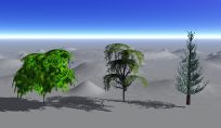
- There is very little plant functionality. Built-in objects include 14 trees, a cactus, and 5 other small plants, not very detailed. Their better trees use their proprietary volumetric textures, which aren't exportable. It is difficult to distribute and "plant" trees on the terrain.
- in mid-2005, DAZ took this old software (previously Corel, etc.) and gave it a fresh release
- $50 for Windows
- Realtime 3D heightmap editor and painter, makes 'maps' up to 4k*4k, with freehand tools for raise/lower/smoothing, freehand painting of terrain color and up to four detail textures. User interface is very fast and smooth.
- Outputs to its own ascii map format, 16-bit PNG, or .OBJ. Imports from image formats.
- $40 from ProFantasy Software, or $145 if bundled with their main product, Campaign Cartographer (CC2 Pro)
- the application's main purpose is creating maps for games
- "Starting from a random world, real-Earth data, or a flat plain, you can 'paint' altitude or climate adjustments"
- includes river networks, a scripting language, and (surprisingly for a artificial game-oriented software) 25 map projections
- exports to "an image, animation, icosahedral, or VRML"
- €540 standard, €190 for small developers
- Procedural creation of geometry using fractal algorithms and natural erosion, procedural textures, creates shadowmaps, distribute objects including vegetation
- UI looks quite powerful and complex; oriented towards game developers
-


- It has a closely-related middleware, Graphite Renderer, based on D3D
 L3DT
by Aaron Torpy
L3DT
by Aaron Torpy- Generates artificial heightfields, including surface materials and water.
- High-level control: Sea vs. Land, Flat vs. Mountains, Rolling vs. Jagged, Wet vs. Dry
- Heightfield brush tools for finer control
- Freeware for Windows, with Professional versions for $35/$150
- Imports and exports and very large number of formats, including BT, TerraGen, HFF (L3DT), bitmap, and JPEG, with export to 3D model formats .obj, .b3d, .3ds, .X, GLScene and others.
- Includes a realtime viewer.
- A small amount of geo-support allows it to import SRTM.
- The pro version handles really big maps, up to 131,072*131,072 for heightfield, 2M × 2M for the texture with a paging system.
- Open-source GPU driven terrain generator, to create and export material textures and heightmaps.
- The terrain algorithms are implemented as GLSL fragment shaders, operating on floating point textures, which allows realtime modification of the terrain.


- tool for creation of terrain, manually as well as automated/randomized terrain generation including heightmaps, texturing, vegetation, seas and rivers, static objects and environmental sounds
- For Windows; free version available with limitations; €45 / €170 for standard/professional editions
- a popular non-commercial raytracing package, which some people use for terrain rendering
- GT is a GUI for using The Genesis Toolkit, which works with heightfields and vegetation for POV-Ray scenes
- simple heightfield editor, $21 for Windows
- up to 1024*1024 heightfields, texture by height and slope, painting of layered textures
- export to B3D and .X
- creates and saves shadowmaps, also claims to produce overhangs
 Terragen
/ Terragen 2
Terragen
/ Terragen 2- Fractal landscape generator/renderer from Planetside Software, $200-$700 depending on use
- Classic version did nice clouds (2D layers) and good sunsets, and import heightfields up to 4097x4097.
- Version 2 added full 3D volumetric clouds and unlimited terrain size, up to a full planet.
- Version 3 added a new DEM system, to natively load and georeference a large variety of elevation formats.
- Emphasis is on non-realtime rendering with beautiful lighting, gets a lot of use in movies etc.
- Has it's own TER file format, as well as supporting standard image formats
- Has a large community of enthusiastic users, producing beautiful images, and sharing elevation files.
 Voxelogic
Acropora
Voxelogic
Acropora- $120, for Windows
- "Create large voluminous terrain meshes... create overhangs, caves, or an endless labyrinth of tunnels with a few mouse clicks."
- Exports to mesh formats (FBX, OBJ, 3DS, DXF, DAE), DDS volume textures, and raw voxel data

- A line of software from E-on software, from $100 to $600 depending on product
- Attractive non-realtime landscape renderer
- Volumetric clouds, nice height-map editor with sophisticated erosion tools, simple interface
- Plants are very realistic, up to 50 of them are included depending on product
- One drawback: i was unable to get it to import any USGS DEM in 2000, although it is probably fixed later (2006). The product literature doesn't distinguish between "DEM" and "2D import", which implies that they don't handle geographic coordinates at all.
- In 2010, they produced a version of Vue + CityEngine (for $300) but this later disappeared, probably when CityEngine was bought by ESRI.
 WorldCreator
- Makes landscapes, with "semi-scientific erosion algorithms" and extensive artistic control of the process.
- The demo videos show powerful-looking terraffectors for vector paths and rivers.
- This is the latest version of the older package called 'GeoControl'
- €150 'Indie' version, €500 for Enterprise.

- $180 standard / $500 pro version, from Digital Element, although apparently no longer sold directly.
- Can read DEM, handle terrain grids up to 4000x4000.
- Very beautiful output rendering, supports multiprocessor.
- "Geomorphic smoothing of landscape surface, simulation of water erosion".
- Automatic and manual road generation.
- Plants ("over 100 L-System generated 3D vegetation specimens") look good, placement of grass well done. The L-System language is built-in and specific to WorldBuilder, so the set of possible plants is not easily extended. Individual species are sold for $40 each (!)
- Water system includes options for ripples, varying color dependent upon water depth and refraction
- $500 from 3D Nature

- landscape creation and rendering with rock, trees, vegetation, moving water and evolving clouds (volumetric clouds, cloud shadows animated on a landscape)
- Terraffector™ technology lets you change the terrain by drawing vectors directly onto the landscape.
- Sun and moon, moon phases, tides.
- Always renders true spherical terrain.
- Can drape satellite imagery, import DLG for major roads, streams, railroads, etc.
- LightWave and 3D Studio MAX scene import/export
- For working with real places or serious GIS data, 3D Nature offers a more professional product, Visual Nature Studio, listed on Commercial Packages
 World
Machine
- A terrain heightfield generator, for Windows, $90 Standard / $180 Pro
- Uses an interesting graph-based visual design approach, connecting a series of operations (noise, erosion etc.) in a easy-to-use visual manner
- Imports/exports to Raw, TGA, BMP, Leveller, and Terragen
- 2D & OpenGL views, many Perlin Noise generator styles, weathering and fluvial erosion, real-time previews of all adjustments

 FreeWorld3D
(freeworld3d.org)

 TechNature
(http://www.tanzanite.to/)