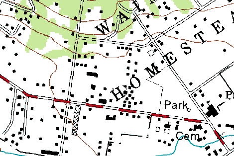
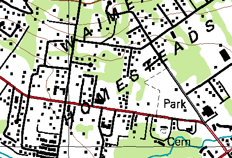
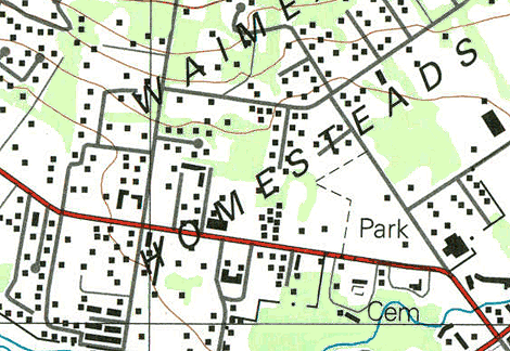
| Type 1, classic | Type 2, NIMA DRG | Type 3, printed topo |
 |
 |
 |
There appear to be three main sets of USGS DRG.
- The "classic" USGS-produced topo maps. They feature high-quality hand-made cartography, including properly oriented buildings. They are largely based on aerial photos taken in the 1970s, with limited "field check and editing" in the early 1980s. Their projection uses the Old Hawaiian Datum.
- NIMA maps distributed by the USGS as DRGs. These maps are much more complete and current, based on aerial photos taken in the early 1990s. However, they suffer from poor cartography, apparently digitized as GIS features then rendered back again to resemble a DRG. This results in bad aliasing, no building rotation, poor placement of feature names, missing attribute markers for features like schools and churches, and other glitches. The data was collected by NIMA (now NGA, military) and transferred to the USGS. Some external contractors were apparently involved as well, including The Land Information Technology Company, Ltd., of Aurora, CO, and Beartooth Mapping, Inc. of Red Lodge, MT.
- NIMA maps distributed by the USGS as printed topo maps. The USGS still distributes paper maps, and these are now also based on the NIMA data. However, they don't suffer as badly from some issues like aliasing, because a better process was used to render the data onto paper than was used to produce the DRG TIFFs.
Type 1, classic Type 2, NIMA DRG Type 3, printed topo
These are the "classic" USGS-produced DRGs.
You can use the clickable index below, or simply browse this folder via HTTP.
Other islands - to be done.